Monitoring and Managing Multi-hazards
 portes grátis
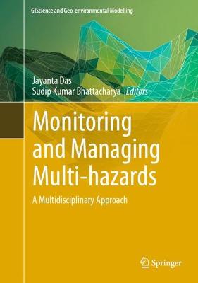
Monitoring and Managing Multi-hazards
A Multidisciplinary Approach
Das, Jayanta; Bhattacharya, Sudip Kumar
Springer International Publishing AG
12/2022
344
Dura
Inglês
9783031153761
15 a 20 dias
1011
Descrição não disponível.
Part 1. Multi-hazards monitoring.- Chapter 1. Evaluating the Multi Hazards Threats Due to Aridity, Sea Level Upsurge in the Coastal Areas of North Tamil Nadu, South India.- Chapter 2. Active Tectonics and Associated Channel shifting pattern of Neora river basin, Darjeeling Himalaya.- Chapter 3. Estimating Soil Loss Rate and Sediment Yield of the Proposed Ngololweni Earth Dam, Kingdom of Eswatini.- Chapter 4. Flood susceptibility mapping using GIS and multi-criteria decision analysis in Dibrugarh district of Assam, North-East India.- chapter 5. Effects of climatic hazards on agriculture in the Teesta basin of Bangladesh.- Chapter 6. Mizoram, the capital of landslide: A review of articles published on landslides in Mizoram, India.- Chapter 7. Deployment of Geostatistical and Geospatial Technology for Groundwater Quality Vulnerability Assessment Using Hydrogeochemical Parameters: A Case Study of NCT Delhi.- Chapter 8. A Literature Review of the Impact of Covid-19 Pandemic on Land Surface Temperature and Air Quality of India.- Chapter 9. Seasonal and Inter-Annual Variation of Chlorophyll and Sea Surface Temperature in Northern and Southern Arabian Sea, India.- Chapter 10. Application of a geospatial based subjective MCDM method for flood susceptibility modeling in Teesta River basin, West Bengal, India.- Chapter 11. Flood Frequency Analysis of Baitarani River using three probability distributions.- Chapter 12. Application of Analytical hierarchy process (AHP) method to flood risk assessment at Sub-Himalayan region using geospatial data: A case study of Alipurduar district, West Bengal, India.- Chapter 13. Remote Sensing and GIS Based Landslide Susceptibility Mapping: A Case Study from Kegalle District, Sri Lanka.- Chapter 14. Landslide Susceptibility Evaluation And Analysis: A Review On Articles Published During 2000 To 2020.- Chapter 15. Assessment of the social impact of arsenicosis through groundwater arsenic poisoning in Maldah district.- Chapter 16. Ground waterdepletion zonation using Geospatial technique and TOPSIS in Raipur District, Chhattisgarh, India.- Part-II. Multi-hazards Management.- Chapter 17. Terrain Sensitivity guided and People's Perception based Risk Area Management of the hills of Darjeeling district, India.- Chapter 18. Wastewater treatment in India- a new perspective.- Chapter 19. Adaptation to climate change in agriculture at Teesta basin in Bangladesh.- Chapter 20. Land use/Land cover change detection through the spatial approach: a case study of the Badiadka panchayath, Kerala.- Chapter 21. Application of AHP and Geospatial technology in Groundwater potentiality mapping: A Case Study from Tamil Nadu, India.- Chapter 22. Expected Climate-Induced Alterations in Sugarcane Yield Distribution and Its Agronomic Adaptation Strategies.- Index.
Este título pertence ao(s) assunto(s) indicados(s). Para ver outros títulos clique no assunto desejado.
Natural Hazards;Anthropogenic Hazards;Geospatial Technique;Multicriteria Decision Making Grid;Resource Management
Part 1. Multi-hazards monitoring.- Chapter 1. Evaluating the Multi Hazards Threats Due to Aridity, Sea Level Upsurge in the Coastal Areas of North Tamil Nadu, South India.- Chapter 2. Active Tectonics and Associated Channel shifting pattern of Neora river basin, Darjeeling Himalaya.- Chapter 3. Estimating Soil Loss Rate and Sediment Yield of the Proposed Ngololweni Earth Dam, Kingdom of Eswatini.- Chapter 4. Flood susceptibility mapping using GIS and multi-criteria decision analysis in Dibrugarh district of Assam, North-East India.- chapter 5. Effects of climatic hazards on agriculture in the Teesta basin of Bangladesh.- Chapter 6. Mizoram, the capital of landslide: A review of articles published on landslides in Mizoram, India.- Chapter 7. Deployment of Geostatistical and Geospatial Technology for Groundwater Quality Vulnerability Assessment Using Hydrogeochemical Parameters: A Case Study of NCT Delhi.- Chapter 8. A Literature Review of the Impact of Covid-19 Pandemic on Land Surface Temperature and Air Quality of India.- Chapter 9. Seasonal and Inter-Annual Variation of Chlorophyll and Sea Surface Temperature in Northern and Southern Arabian Sea, India.- Chapter 10. Application of a geospatial based subjective MCDM method for flood susceptibility modeling in Teesta River basin, West Bengal, India.- Chapter 11. Flood Frequency Analysis of Baitarani River using three probability distributions.- Chapter 12. Application of Analytical hierarchy process (AHP) method to flood risk assessment at Sub-Himalayan region using geospatial data: A case study of Alipurduar district, West Bengal, India.- Chapter 13. Remote Sensing and GIS Based Landslide Susceptibility Mapping: A Case Study from Kegalle District, Sri Lanka.- Chapter 14. Landslide Susceptibility Evaluation And Analysis: A Review On Articles Published During 2000 To 2020.- Chapter 15. Assessment of the social impact of arsenicosis through groundwater arsenic poisoning in Maldah district.- Chapter 16. Ground waterdepletion zonation using Geospatial technique and TOPSIS in Raipur District, Chhattisgarh, India.- Part-II. Multi-hazards Management.- Chapter 17. Terrain Sensitivity guided and People's Perception based Risk Area Management of the hills of Darjeeling district, India.- Chapter 18. Wastewater treatment in India- a new perspective.- Chapter 19. Adaptation to climate change in agriculture at Teesta basin in Bangladesh.- Chapter 20. Land use/Land cover change detection through the spatial approach: a case study of the Badiadka panchayath, Kerala.- Chapter 21. Application of AHP and Geospatial technology in Groundwater potentiality mapping: A Case Study from Tamil Nadu, India.- Chapter 22. Expected Climate-Induced Alterations in Sugarcane Yield Distribution and Its Agronomic Adaptation Strategies.- Index.
Este título pertence ao(s) assunto(s) indicados(s). Para ver outros títulos clique no assunto desejado.

