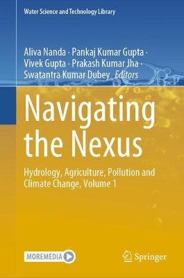
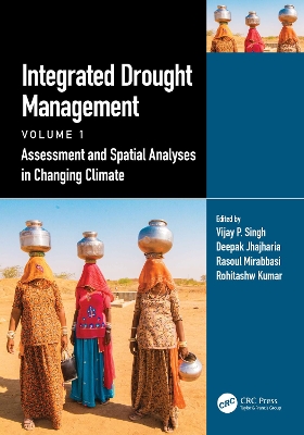
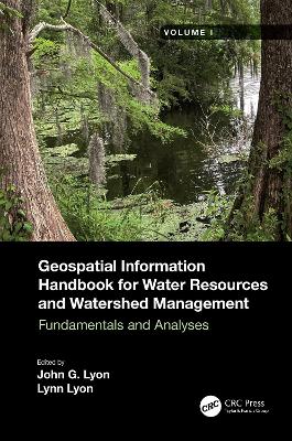
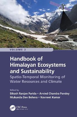
Handbook of Himalayan Ecosystems and Sustainability, Volume 2
portes grátis
Handbook of Himalayan Ecosystems and Sustainability, Volume 2
Spatio-Temporal Monitoring of Water Resources and Climate
Parida, Bikash Ranjan; Pandey, Arvind Chandra; Behera, Mukunda Dev; Kumar, Navneet
Taylor & Francis Ltd
11/2022
380
Dura
Inglês
9781032203157
15 a 20 dias
Descrição não disponível.
Introduction to Himalaya. Section 1: Geospatial Approaches for Monitoring Cryosphere and Hydro- Climatic Disasters. Monitoring Spatio-Temporal Glacier Dynamics and Snow Cover Variability Focused on Runoff Variability Among Major Glaciers in Zanskar Valley, Ladakh, India. Glacier Velocity Estimation Over Select Large Glaciers in Himalaya. Monitoring Spatio-Temporal Patterns of Glacial Lakes in Sikkim Himalayas Using Satellite Data and Nonparametric Statistical Testing Techniques. Monitoring Flooding Inundation Using SAR Data: A Case Study on Brahamputra River Basin. Modelling Floodwater Depth Using GIS-Based Spatial Statistical Technique: A Case Study on Gandak River Basin. Identification of Flood Hotspot Zone Using GIS-Based Spatial Statistical Technique: A Case Study on Kosi River Basin. Section 2. Geospatial Approaches for Monitoring Water Resources and Climate Change. Climate Change Impact on Hydrological Extremes of Himalayan River Basin in Hindu-Kush Himalayan Region. Climate Change Projections Using CMIP6 Gcms in Himalayan River Basin: A Case Study in Koshi River Basin, Nepal. Impact of Structural Barriers on the Morphology and Ecology of the Himalayan Rivers. Modeling the Potential Impact of Land Use and Land Cover Change on the Hydrology of Himalayan River Basin: A Case Study of Manipur River, India. The Application of Remote Sensing for Water Resources Management in Data-Scarce Watersheds in the Hindukush-Himalaya Region: A Case of Kabul River Basin. Management Issues of Wetlands in Himalayan Foothills: A Case Study of Baigul Wetland. Section 3: Geospatial Approaches for Monitoring Urban Ecosystem. Urban Sprawl and Future Growth Projection Vis A Vis Groundwater Resource Availability in Hill Township of Shillong, India. Effect of Lockdown on Aerosol Optical Depth and NO2 Over Major Cities of Indian Himalayan Region. Study on Spatial Distribution, Temporal Variation and Growth Trends of Particulate Matter, Sulfur Dioxide, Nitrogen Oxides and Ammonia from Anthropogenic Sources Over India. Spatial Distribution of Particulate Organic Carbon Over India and Prediction of its Deposition in the Himalayas Through GIS-WRF-Camx Modeling System.
Este título pertence ao(s) assunto(s) indicados(s). Para ver outros títulos clique no assunto desejado.
- Ciência agrícola
- Florestação e silvicultura: prática e técnicas
- Geografia humana
- Hidrologia e da hidrosfera
- Engenahria civil, levantamentos e construção
- Ciência ambiental, engenharia e tecnologia
- Poluição e ameaças ambientais
- Biodiversidade
- Sistemas de informação geográfica (GIS) e observação remota
Land use land cover;Biodiversity;Forest cover dynamics;Urban sprawl;Nitrogen oxides;Water Resources Management;Air pollution;Glacial Lake;Himalayan River;Geospatial modelling;Climate Change;Landscape restoration;Urban Heat Islands;Data Set;Glacier Melt Runoff;Spatio Temporal Monitoring;LST Estimation;LST;Siachen Glacier;Emission Loads;AOD Concentration;Landsat OLI;SCA;Tamil Nadu;LULC Class;Data Scarce Regions;Emission Inventory;Emission Inventory Development;Hindu Kush Himalaya Region;Open Burning;Snowmelt Runoff;Flood Extent;Himalayan Region;Himalayan Range;CMIP6 Project;Jth Band
Introduction to Himalaya. Section 1: Geospatial Approaches for Monitoring Cryosphere and Hydro- Climatic Disasters. Monitoring Spatio-Temporal Glacier Dynamics and Snow Cover Variability Focused on Runoff Variability Among Major Glaciers in Zanskar Valley, Ladakh, India. Glacier Velocity Estimation Over Select Large Glaciers in Himalaya. Monitoring Spatio-Temporal Patterns of Glacial Lakes in Sikkim Himalayas Using Satellite Data and Nonparametric Statistical Testing Techniques. Monitoring Flooding Inundation Using SAR Data: A Case Study on Brahamputra River Basin. Modelling Floodwater Depth Using GIS-Based Spatial Statistical Technique: A Case Study on Gandak River Basin. Identification of Flood Hotspot Zone Using GIS-Based Spatial Statistical Technique: A Case Study on Kosi River Basin. Section 2. Geospatial Approaches for Monitoring Water Resources and Climate Change. Climate Change Impact on Hydrological Extremes of Himalayan River Basin in Hindu-Kush Himalayan Region. Climate Change Projections Using CMIP6 Gcms in Himalayan River Basin: A Case Study in Koshi River Basin, Nepal. Impact of Structural Barriers on the Morphology and Ecology of the Himalayan Rivers. Modeling the Potential Impact of Land Use and Land Cover Change on the Hydrology of Himalayan River Basin: A Case Study of Manipur River, India. The Application of Remote Sensing for Water Resources Management in Data-Scarce Watersheds in the Hindukush-Himalaya Region: A Case of Kabul River Basin. Management Issues of Wetlands in Himalayan Foothills: A Case Study of Baigul Wetland. Section 3: Geospatial Approaches for Monitoring Urban Ecosystem. Urban Sprawl and Future Growth Projection Vis A Vis Groundwater Resource Availability in Hill Township of Shillong, India. Effect of Lockdown on Aerosol Optical Depth and NO2 Over Major Cities of Indian Himalayan Region. Study on Spatial Distribution, Temporal Variation and Growth Trends of Particulate Matter, Sulfur Dioxide, Nitrogen Oxides and Ammonia from Anthropogenic Sources Over India. Spatial Distribution of Particulate Organic Carbon Over India and Prediction of its Deposition in the Himalayas Through GIS-WRF-Camx Modeling System.
Este título pertence ao(s) assunto(s) indicados(s). Para ver outros títulos clique no assunto desejado.
- Ciência agrícola
- Florestação e silvicultura: prática e técnicas
- Geografia humana
- Hidrologia e da hidrosfera
- Engenahria civil, levantamentos e construção
- Ciência ambiental, engenharia e tecnologia
- Poluição e ameaças ambientais
- Biodiversidade
- Sistemas de informação geográfica (GIS) e observação remota
Land use land cover;Biodiversity;Forest cover dynamics;Urban sprawl;Nitrogen oxides;Water Resources Management;Air pollution;Glacial Lake;Himalayan River;Geospatial modelling;Climate Change;Landscape restoration;Urban Heat Islands;Data Set;Glacier Melt Runoff;Spatio Temporal Monitoring;LST Estimation;LST;Siachen Glacier;Emission Loads;AOD Concentration;Landsat OLI;SCA;Tamil Nadu;LULC Class;Data Scarce Regions;Emission Inventory;Emission Inventory Development;Hindu Kush Himalaya Region;Open Burning;Snowmelt Runoff;Flood Extent;Himalayan Region;Himalayan Range;CMIP6 Project;Jth Band