Encounters in the New World
 portes grátis
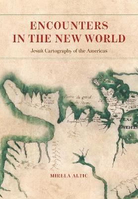
Encounters in the New World
Jesuit Cartography of the Americas
Altic, Mirela
The University of Chicago Press
07/2022
504
Dura
Inglês
9780226791050
15 a 20 dias
Descrição não disponível.
List of Abbreviations
Introduction
1 The History and Concept of Jesuit Mapmaking
1.1 The Organization of the Society of Jesus and Its Educational System
1.2 The Society of Jesus in the Age of Encounter and Exploration
1.3 Cartographers of Heaven and Earth
1.4 The Emergence and Development of Jesuit Cartography in the Americas
1.5 Techniques of Jesuit Mapmaking
1.6 Editorial Interventions into Jesuit maps: Originals and Their Edited Versions
1.7 The Iconography of Jesuit Maps
1.8 The Dissemination of Jesuit Maps and Their Impact on European Cartography
1.9 Changing the Discourse: Post-Suppression Jesuit Cartography
2 The Possessions of the Spanish Crown
2.1 The Viceroyalty of New Spain
2.1.1 The Jesuit Cartographic Endeavor in Florida
2.1.2 Mexico: Missionary Cartography of the Borderlands
2.1.2.1 Ivan Rattkay: Cartographic Pioneer of the Tarahumara Region
2.1.2.2 Adam Gilg and the Art of Surveying in the Province of Sonora
2.1.2.3 Eusebio Francisco Kino and His Followers: Mapping the Northwestern Frontier
2.1.2.4 Cartographic Synthesis from the Time of the Military and Juridical Reorganization of New Spain
2.1.2.5 Mapmaking Attempts in Sinaloa
2.1.2.6 The Jesuit Cartography of Nayarit
2.1.2.7 Juan Nentwig and Bernhard Middendorff: Cartographers of the Pima Uprising and Its Aftermath
2.1.3 Baja California: Revealing a Geographical Enigma
2.1.3.1 Eusebio Francisco Kino and the Appearance of the First Jesuit Maps of Baja California
2.1.3.2 Ferdinand Konscak (Fernando Consag): Confirming the Peninsularity
2.2 The Viceroyalty of Peru
2.2.1 The Province of Peru: Mapping the Moxos Missions
2.2.2 The Jesuit Cartography of Chile: Between Mythology and Utilitarianism
2.2.3 Patagonia: Jesuits at the Southern Edge of the Spanish Empire
2.2.4 The Province of Paraguay and the Rio de la Plata: The Cartography of Conflicts and Martyrs
2.2.4.1 Cartographic Reflections of the Treaty of Madrid
2.2.4.2 The Jesuit Cartography of the Guarani War and Its Aftermath
2.2.4.3 The Post-Suppression Jesuit Cartography of Paraguay
2.2.5 The Province of Quito: Challenging Border Disputes along the Amazon
2.2.5.1 The Post-Suppression Vision of Quito: From Territorialization to Idealism
2.2.6 New Granada: Defense and Commerce in the Orinoco River Region
3 Portuguese Possessions: Brazil
3.1 The Jesuit Mapping of Brazil: Cartography of the Edges of the Empire
3.1.1 Claiming the Amazon and Setting the Northern Brazilian Border with French Guiana
3.1.2 Mapping the Western Edge of the Empire: The Jesuit View of Minas Gerais
3.1.3 At the Southern Edge: The Jesuit Cartography of Colonia do Sacramento, Santa Catarina, and Rio Grande do Sul
3.1.4 Back to the Northern Edge: The Amazon in the Aftermath of the Treaty of Madrid
4 New France: Searching for the Northwest Passage
4.1 The Early Jesuit Mapping of Huronia
4.2 Cartography under Iroquois Attacks: A New Discourse by Francesco Giuseppe Bressani
4.3 Mapping the Western Great Lakes (Huron, Michigan, and Superior)
4.4 Jacques Marquette and His Breakthrough to the Mississippi River
4.5 Pierre Raffeix and His Contribution to the Mapping of the Iroquois Country
4.6 The Final Decline of Jesuit Mapping in New France
Concluding Remarks
Notes
Bibliography
Index
Este título pertence ao(s) assunto(s) indicados(s). Para ver outros títulos clique no assunto desejado.
cartography;cartographers;maps;map history;historical context;missionary;international cartographic association commission;discoveries;mapping;mapmaking;mapmakers;new world;americas;jesuits;missionaries;humanitarian;evangelization;indigenous populations;native peoples;colonialism;colonial;exploration;empire;cultural studies;culture;communication;territory;iconography;religion;religious;spain;france;portuguese


