Atmospheric Remote Sensing
 -10%
portes grátis
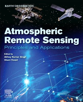
Atmospheric Remote Sensing
Principles and Applications
Tiwari, Shani; Kumar Singh, Abhay
Elsevier - Health Sciences Division
11/2022
480
Mole
Inglês
9780323992626
15 a 20 dias
Descrição não disponível.
Section 1: Principles of atmospheric remote sensing 1. Satellite Remote Sensing Aerosol Optical Depth (AOD) Retrievals: accuracy assessment, limitations, and usage recommendations over Asia 2. Earth Observation Satellites (EOS) for global sustainability: Potentials and boundaries 3. Remote Sensing and its implication to air pollution studies 4. Global Navigation Satellite System and its Application in Remote Sensing of Atmosphere 5. Estimation of Ionospheric Total Electron Content (TEC) from GNSS observations 6. Impact of water vapor on atmospheric correction of satellite images
Section 2: Application of atmospheric remote sensing 7. Identification of fires over the Indian region from space 8. Identification of different aerosol types observed at a semi-arid location in southern peninsular India retrieved from the CALIPSO 9. Remote sensing of clouds: challenges and way forward 10. Study of Aerosol - Cloud Interaction over Indian region using satellite remote sensing 11. Aerosol loading over the Northern Indian ocean using spaceborne measurement 12. Balloon - based remote sensing of Atmosphere 13. Vertical distribution of atmospheric brown clouds using LiDAR remote sensing over Indian region 14. Application of Remote Sensing to study forest fires over the Himalayan region 15. Study of the atmospheric and ionospheric phenomenon using GPS based remote sensing technique 16. Low-latitude lower ionosphere remote sensing using very low frequency (VLF) waves 17. Remote Sensing of Ionosphere, Plasmasphere, and Magnetosphere by VLF Wave 18. Remote Sensing of Ionospheric Irregularities 19. Application of atmospheric remote sensing in disaster management 20. Characteristics of tropical cyclones through remote sensing observations and techniques 21. Significance of Remote sensing in Tropical Cyclone prediction and disaster management: Indian perspective 22. Study of dust storm characteristics over Indo - Gangetic Basin through satellite remote sensing 23. Geomorphological mapping of glacial and periglacial landforms using Remote Sensing: Examples from semi-arid and sub-humid Himalayan valleys 24. Classification of Remotely sensed Formosat-2 Haridwar data using Deep Learning Artificial Neural Network and Convolutional Neural Network 25. Remote sensing-based study of landslide hazard zonation in Namchi and its surrounding area of Sikkim, India
Section 2: Application of atmospheric remote sensing 7. Identification of fires over the Indian region from space 8. Identification of different aerosol types observed at a semi-arid location in southern peninsular India retrieved from the CALIPSO 9. Remote sensing of clouds: challenges and way forward 10. Study of Aerosol - Cloud Interaction over Indian region using satellite remote sensing 11. Aerosol loading over the Northern Indian ocean using spaceborne measurement 12. Balloon - based remote sensing of Atmosphere 13. Vertical distribution of atmospheric brown clouds using LiDAR remote sensing over Indian region 14. Application of Remote Sensing to study forest fires over the Himalayan region 15. Study of the atmospheric and ionospheric phenomenon using GPS based remote sensing technique 16. Low-latitude lower ionosphere remote sensing using very low frequency (VLF) waves 17. Remote Sensing of Ionosphere, Plasmasphere, and Magnetosphere by VLF Wave 18. Remote Sensing of Ionospheric Irregularities 19. Application of atmospheric remote sensing in disaster management 20. Characteristics of tropical cyclones through remote sensing observations and techniques 21. Significance of Remote sensing in Tropical Cyclone prediction and disaster management: Indian perspective 22. Study of dust storm characteristics over Indo - Gangetic Basin through satellite remote sensing 23. Geomorphological mapping of glacial and periglacial landforms using Remote Sensing: Examples from semi-arid and sub-humid Himalayan valleys 24. Classification of Remotely sensed Formosat-2 Haridwar data using Deep Learning Artificial Neural Network and Convolutional Neural Network 25. Remote sensing-based study of landslide hazard zonation in Namchi and its surrounding area of Sikkim, India
Este título pertence ao(s) assunto(s) indicados(s). Para ver outros títulos clique no assunto desejado.
Aerosol, Cyclone; dust storm; GPS; GNSS' satellite' VLF waves; ionosphere; data extraction techniques; satellite data retrievals; data handling and inversion techniques
Section 1: Principles of atmospheric remote sensing 1. Satellite Remote Sensing Aerosol Optical Depth (AOD) Retrievals: accuracy assessment, limitations, and usage recommendations over Asia 2. Earth Observation Satellites (EOS) for global sustainability: Potentials and boundaries 3. Remote Sensing and its implication to air pollution studies 4. Global Navigation Satellite System and its Application in Remote Sensing of Atmosphere 5. Estimation of Ionospheric Total Electron Content (TEC) from GNSS observations 6. Impact of water vapor on atmospheric correction of satellite images
Section 2: Application of atmospheric remote sensing 7. Identification of fires over the Indian region from space 8. Identification of different aerosol types observed at a semi-arid location in southern peninsular India retrieved from the CALIPSO 9. Remote sensing of clouds: challenges and way forward 10. Study of Aerosol - Cloud Interaction over Indian region using satellite remote sensing 11. Aerosol loading over the Northern Indian ocean using spaceborne measurement 12. Balloon - based remote sensing of Atmosphere 13. Vertical distribution of atmospheric brown clouds using LiDAR remote sensing over Indian region 14. Application of Remote Sensing to study forest fires over the Himalayan region 15. Study of the atmospheric and ionospheric phenomenon using GPS based remote sensing technique 16. Low-latitude lower ionosphere remote sensing using very low frequency (VLF) waves 17. Remote Sensing of Ionosphere, Plasmasphere, and Magnetosphere by VLF Wave 18. Remote Sensing of Ionospheric Irregularities 19. Application of atmospheric remote sensing in disaster management 20. Characteristics of tropical cyclones through remote sensing observations and techniques 21. Significance of Remote sensing in Tropical Cyclone prediction and disaster management: Indian perspective 22. Study of dust storm characteristics over Indo - Gangetic Basin through satellite remote sensing 23. Geomorphological mapping of glacial and periglacial landforms using Remote Sensing: Examples from semi-arid and sub-humid Himalayan valleys 24. Classification of Remotely sensed Formosat-2 Haridwar data using Deep Learning Artificial Neural Network and Convolutional Neural Network 25. Remote sensing-based study of landslide hazard zonation in Namchi and its surrounding area of Sikkim, India
Section 2: Application of atmospheric remote sensing 7. Identification of fires over the Indian region from space 8. Identification of different aerosol types observed at a semi-arid location in southern peninsular India retrieved from the CALIPSO 9. Remote sensing of clouds: challenges and way forward 10. Study of Aerosol - Cloud Interaction over Indian region using satellite remote sensing 11. Aerosol loading over the Northern Indian ocean using spaceborne measurement 12. Balloon - based remote sensing of Atmosphere 13. Vertical distribution of atmospheric brown clouds using LiDAR remote sensing over Indian region 14. Application of Remote Sensing to study forest fires over the Himalayan region 15. Study of the atmospheric and ionospheric phenomenon using GPS based remote sensing technique 16. Low-latitude lower ionosphere remote sensing using very low frequency (VLF) waves 17. Remote Sensing of Ionosphere, Plasmasphere, and Magnetosphere by VLF Wave 18. Remote Sensing of Ionospheric Irregularities 19. Application of atmospheric remote sensing in disaster management 20. Characteristics of tropical cyclones through remote sensing observations and techniques 21. Significance of Remote sensing in Tropical Cyclone prediction and disaster management: Indian perspective 22. Study of dust storm characteristics over Indo - Gangetic Basin through satellite remote sensing 23. Geomorphological mapping of glacial and periglacial landforms using Remote Sensing: Examples from semi-arid and sub-humid Himalayan valleys 24. Classification of Remotely sensed Formosat-2 Haridwar data using Deep Learning Artificial Neural Network and Convolutional Neural Network 25. Remote sensing-based study of landslide hazard zonation in Namchi and its surrounding area of Sikkim, India
Este título pertence ao(s) assunto(s) indicados(s). Para ver outros títulos clique no assunto desejado.

